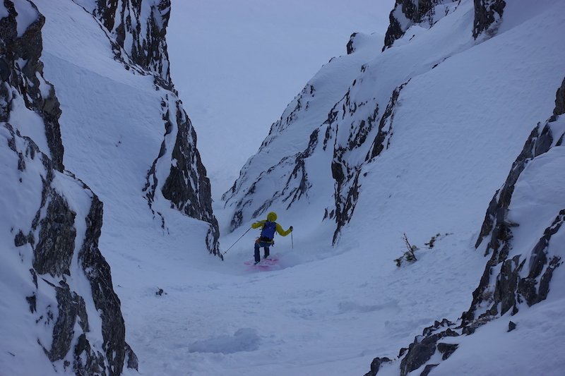
There are many lovely spots to take in the Wasatch and the summit of North Timpanogos is one of the finest! Our long and twisted descent begins from the summit, descends the ridge a few hundred feet. From here angle skiers right a little, to the east and you’ll find your tips dangling over the face. A ski cut on rope can be a good idea here, drop in and enjoy several thousand feet of upper 30 degree skiing. Trend left, there are some little chutes and ridges to play on, but then the slope just opens wide and you can open it up. There is a short tree lined couloir on the skiers left side that you’ll want to connect to and ski through. This dumps you onto a steeper and narrower angling chute that sends you back to the right and towards the cliffs. There is a tight and steep rocky section. After this there are a few options to get to the exit chute, there is a really steep couloir that dumps directly in, or you can traverse a ribbon of snow till you can look right down the exit chute. Once you’re into this final pitch you may encounter a 70 degree ice bulge about halfway down. There is very poor rock to place pro on the skiers right, or it can be downclimbed with crampons and an axe. Enjoy the final few hundred feet of real tight skiing that finishes with a wide open apron and right back down to your approach tracks.
There are two main ways to reach the North summit of Timpanogos where the line begins. First is shorter in distance, but further in vertical. Park at the Mutual Dell campground in American Fork, follow the trail through the woods till it hits the Timpooneke Road, then follow this mellow contouring road that wraps around to the west until you reach the base of Cold Fusion, skin up it or stick to the trees on the west until you hit the ridge, then continue to the summit. The second option is just to continue driving to the end of the Alpine Scenic Loop Highway and park at the lot. From here continue on foot to the Timpooneke Campground and contour around the mountain on the Timpooneke road to the west until you come upon the apron of Cold Fusion, skin up it if it’s safe, or stick to the trees until the ridge then continue to the summit.
Steep exposed travers, possible short down climb or rappel in lower chute.
Call the mountain “Timp” and you’ll sound like a local. Also, this line doesn’t come into shape every year and it can be a tricky one to scope. The best way is by traversing under the face and scouting the exit chute and the exposed traverse. If it doesn’t look good, you can just drop your rope and gear and go ski Cold Fusion as a consolation prize. Also, the Grunge Couloir can be used to approach, it’s shorter and more direct, but you don’t get to look at the line.
