Please make an appointment for bootfitting.


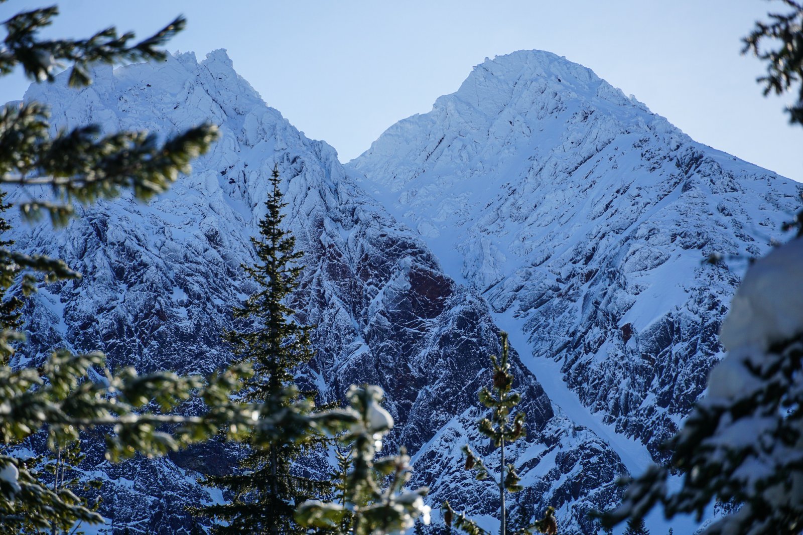
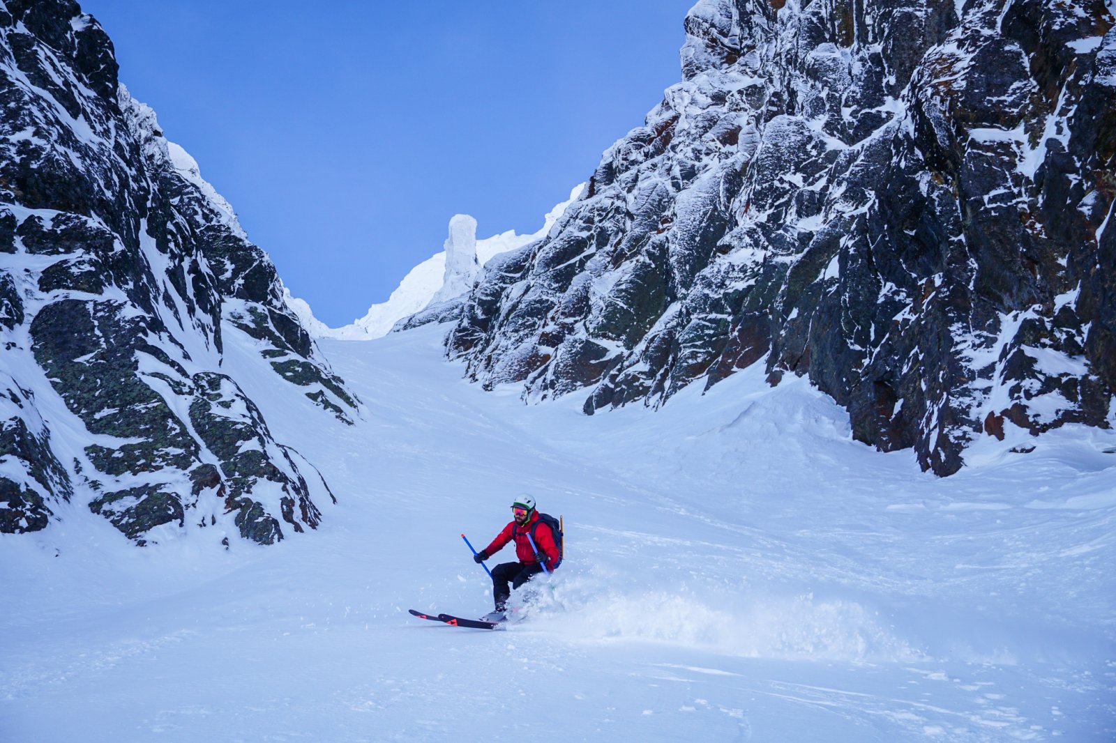
The NW Couloir of Big Chiwaukum is a striking line, cutting through the Chiwaukum Range, a high range of mysterious peaks east of Stevens Pass. It is prominent and highly visible on a clear day from the Stevens Pass ski resort. Many see it and ponder what it would be like, but few experience it.
The NW Couloir presents an excellent opportunity for a more adventurous objective during mid-winter conditions, as the access is reasonable year round. The single alpine aspect (NW) makes the terrain easier to manage with regards to avalanche safety versus a more complex tour. All of these factors make this objective prime for some mid-winter exploring.
It is probably best to have at least a few feet of snow down on the ground at 3k before attempting this line. The long flat valley approach needs to have enough snow coverage to make skinning simple. For this reason, the line usually is not in before January and probably is out after April.
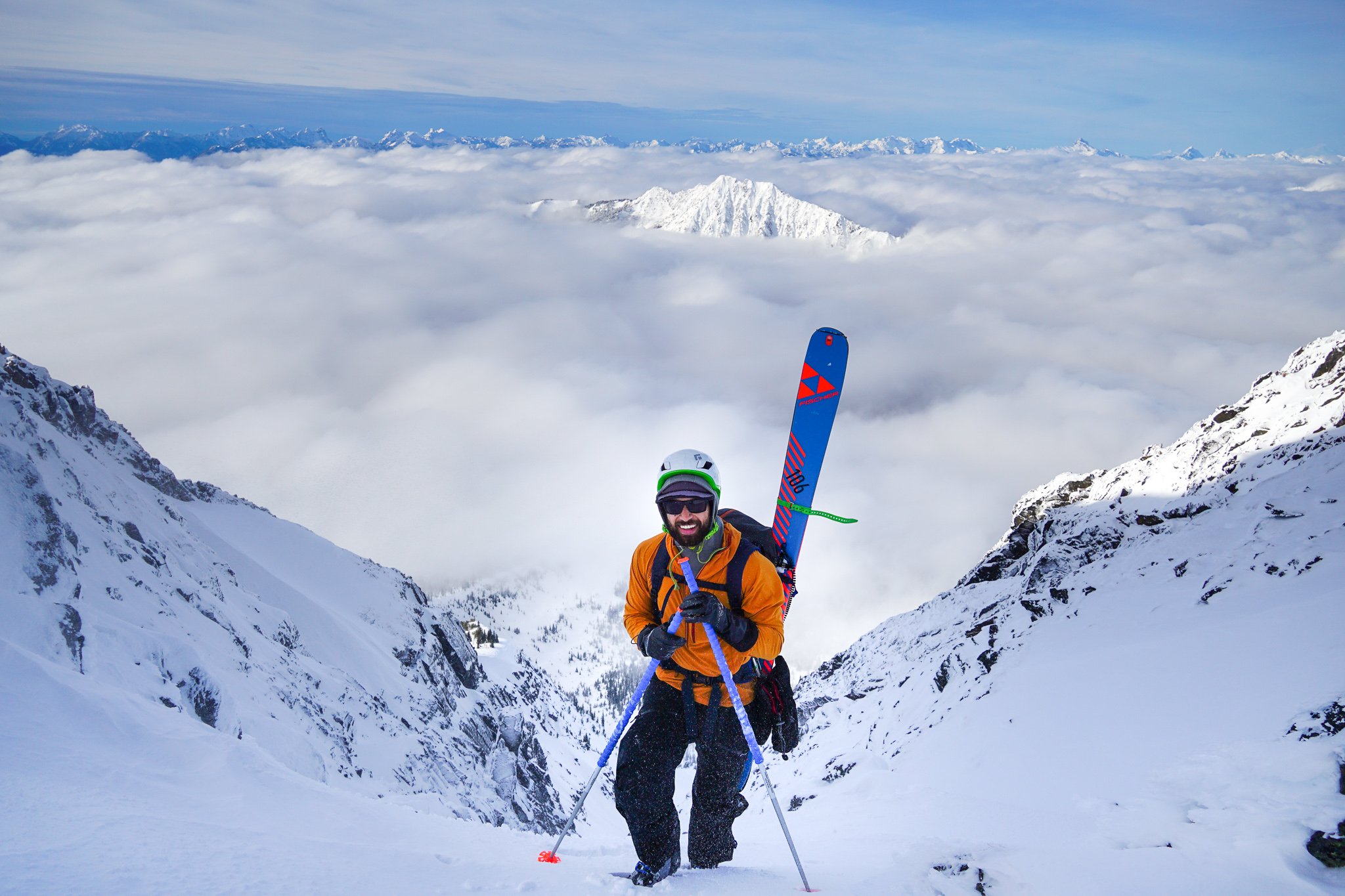
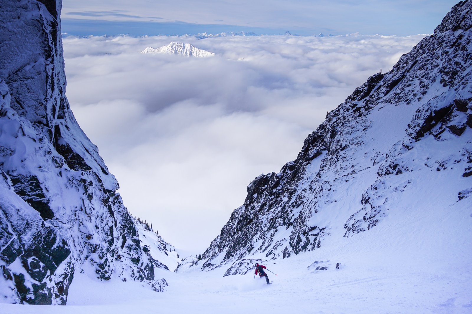
Whether you scramble the final, challenging section to the summit or not, be sure to appreciate the wide-reaching views from the Eastern Valleys to the Glacier Peak Wilderness all the way to the Olympics. Then click in, get your jump turns ready, and ski back down the way you came.
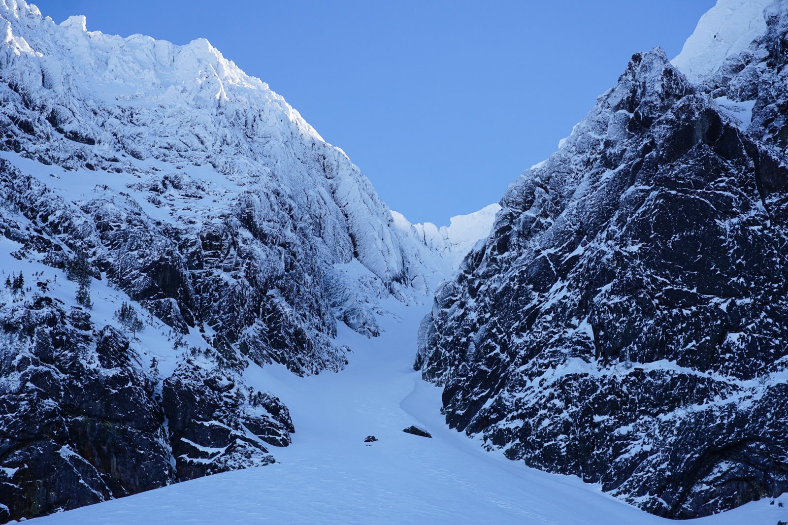
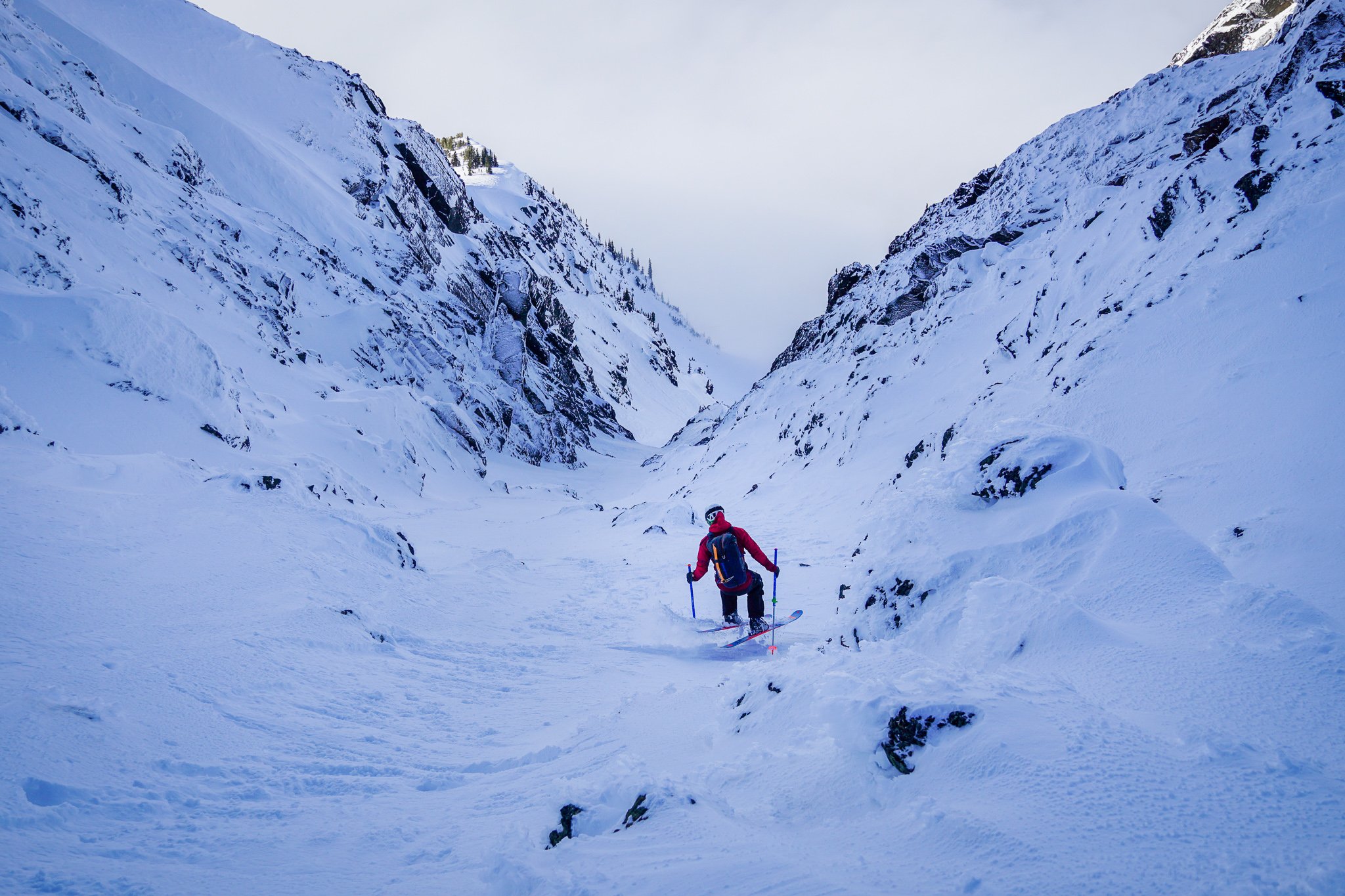
The approach to the NW Couloir is long but generally straightforward. Park halfway down the Whitepine Road off US2 and skin the road, then follow the summer hiking trail slowly up valley. Where Whitehorse Creek branches off, continue following the general direction of the trail towards Big Chiwaukum. Around 5000 ft, leave the trail and skin directly towards Big Chiwaukum. You should break out of the trees and the twin couloirs will be obvious. When viewed from below, the NW Couloir is the climber's right line. The left line might be steeper, but it is shorter and the topout is often rocky. Boot up the couloir, which tops out about 200 ft below the actual summit, a challenging scramble in winter conditions.
The Whitepine Road gets plowed during winter until about 2 miles from the Whitepine Trailhead. The plowing is done by Cascade Meadows Camp. Please call or email ahead to reserve a parking spot and donate to their private funds for plowing this road and keeping access for skiers. You will follow the path of the summer trail quite closely at first on the approach. January to March usually provides optimal snow coverage for this long, low elevation approach.
The long valley approach and exit is likely the crux. You might have to skin both ways in the valley bottom. Give yourself plenty of time and make sure to bring a headlamp.
Finishing the day with a burger and milkshake or beer from 59 Diner down the road makes for a perfect ending.