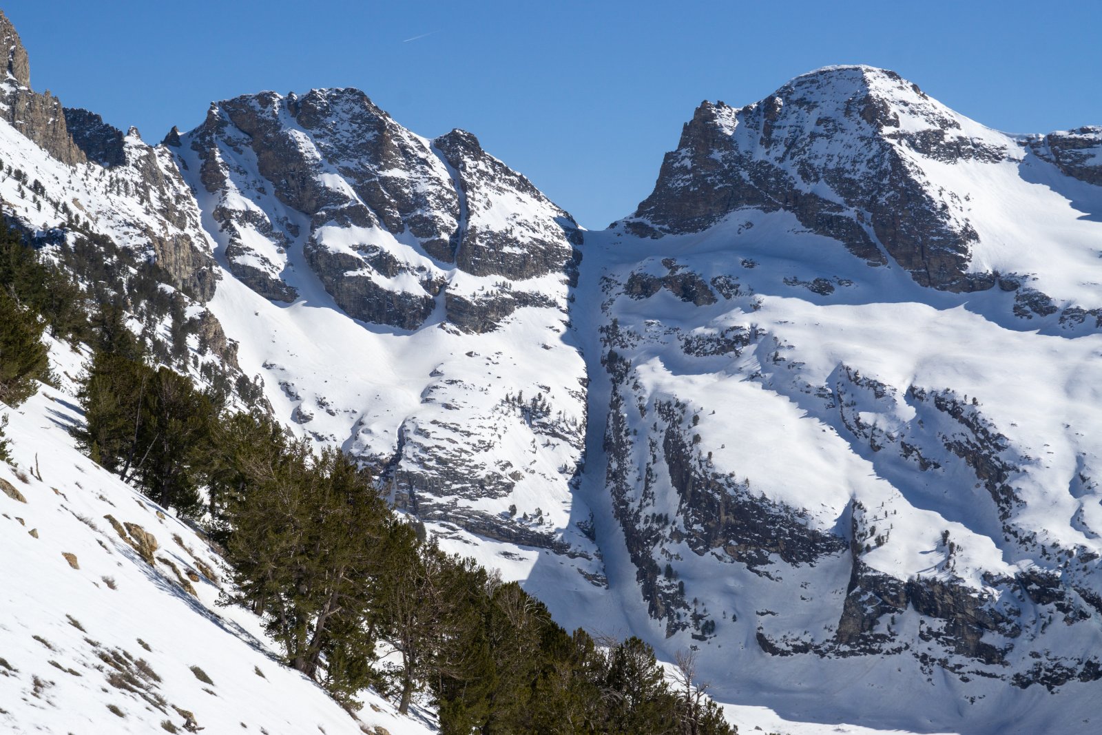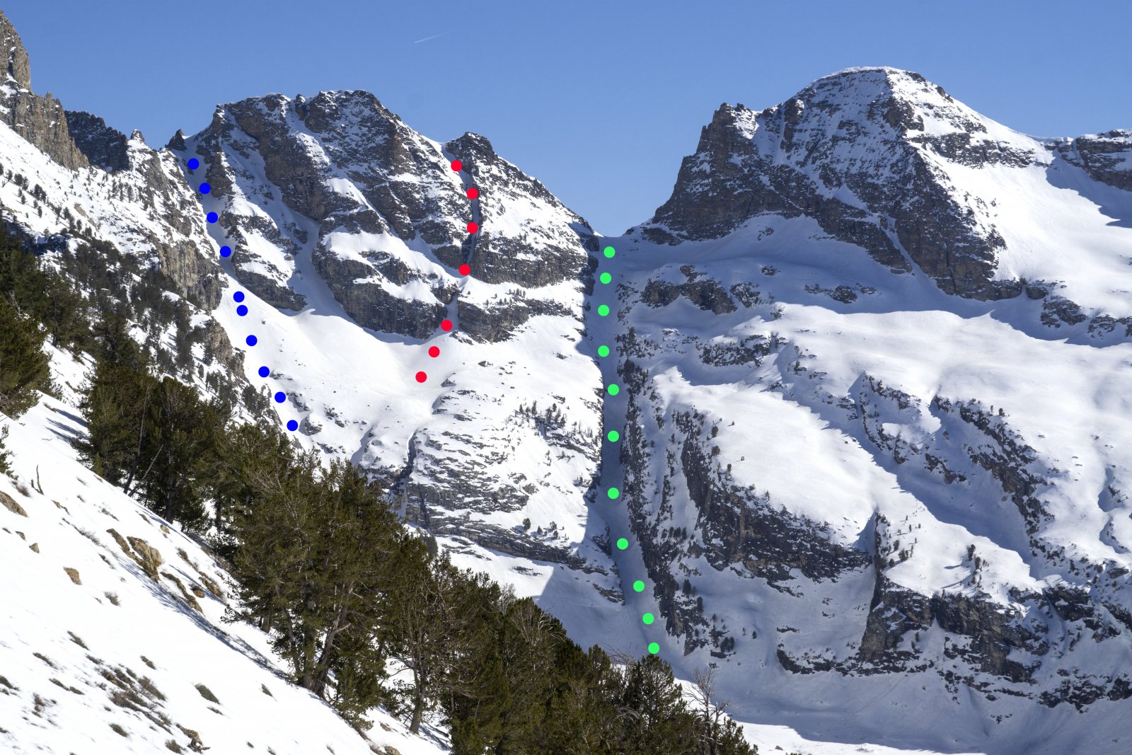
Not one, not two, but three splitter couloirs await you at the upper terminus of Seitz Canyon. At the heart of the Ruby Mountain high country, this terrain is relatively easy to access, yet simultaneously feels remote and wild. While everyone else in Lamoille Canyon heads off to join the conga line up Terminal Cancer, you can put in just a bit more effort to get these equally worthy lines all to yourself. Each of the three offers something different than the others, and all three deserve to be skied. Heck, you worked hard to get back there, might as well cash in while you can!

The skier's left line, the West Seitz Couloir (also called the Come Line by the Heli operation) is fairly wide, low angle (max 33-35 degrees), and a blast to party ski when conditions are right. The Ruby Mountain Heli folks do occasionally drop people at the top of this one, so maybe make this your first stop so you can beat the rotor-assisted crew to the freshies. Smack some high fives before stomping in a skinner right back up. At the top, head east to check out the other two options, both longer and a little spicier.
The East Seitz Couloir is a real stunner. A near-perfect angle for skiing, steep enough to require your attention, but not too steep as to stop you from letting it rip. The Central Couloir is a drool-inducing double fall line beauty.
Steep and complex, the Central Couloir is a truly special place to be. It is not insanely steep, but certainly steep enough to warrant some hop turns. The skier's left cliff wall bows out overhead almost enveloping you into the mountain. Two tight pinches require your attention before letting you loose on the bottom section as you pick your own adventure back to the skintrack. The first pinch is barely over a ski length in width.
Don't forget that you have to climb your way out to get back to the car, so leave enough gas in the tank for that final push. Each line is approximately 1,500 ft. To ski just one line is about 6,300' including the approach.
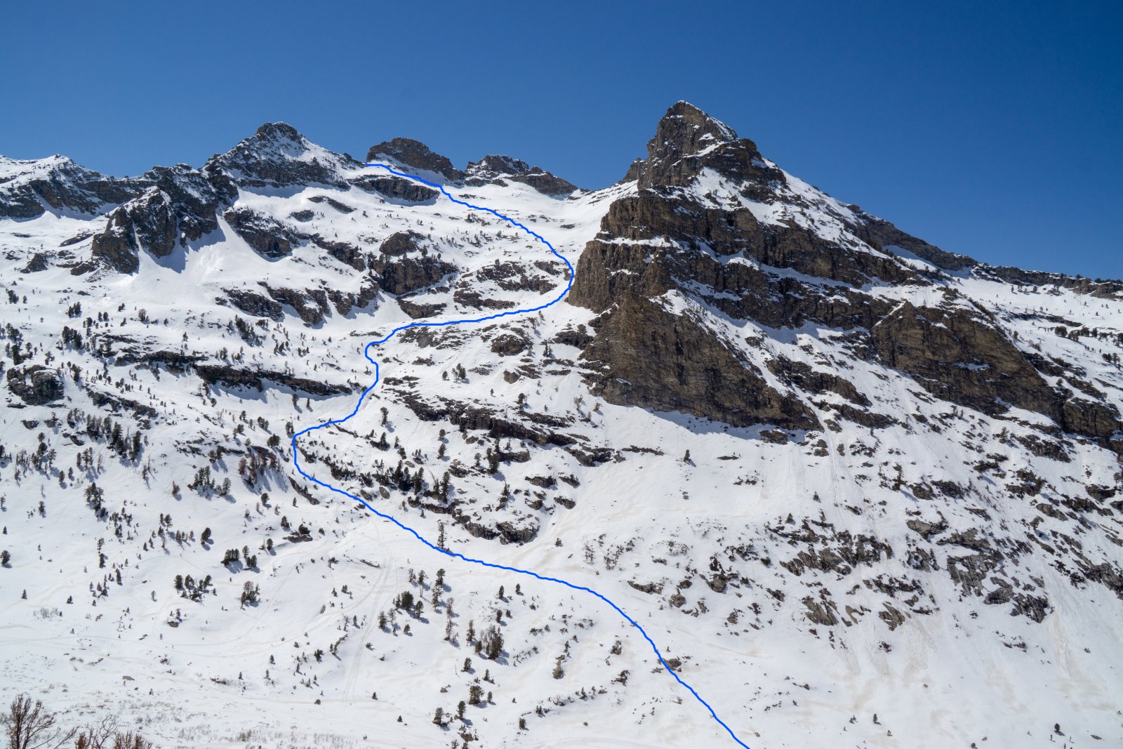
There are numerous ways to approach the Seitz Headwall. There are reports of people gaining access to the Spring Creek Association land in the lower reaches of Rabbit Creek and meandering all the way back from the foothills. This method does require you to arrange key pick-up and drop-off with the HOA. In addition, you face a solid 6 mile trail approach to the base of the lines. The author has also approached by going up and over the canyon's east ridge just south of point 9942...but this is not a recommended way of getting to the goods.

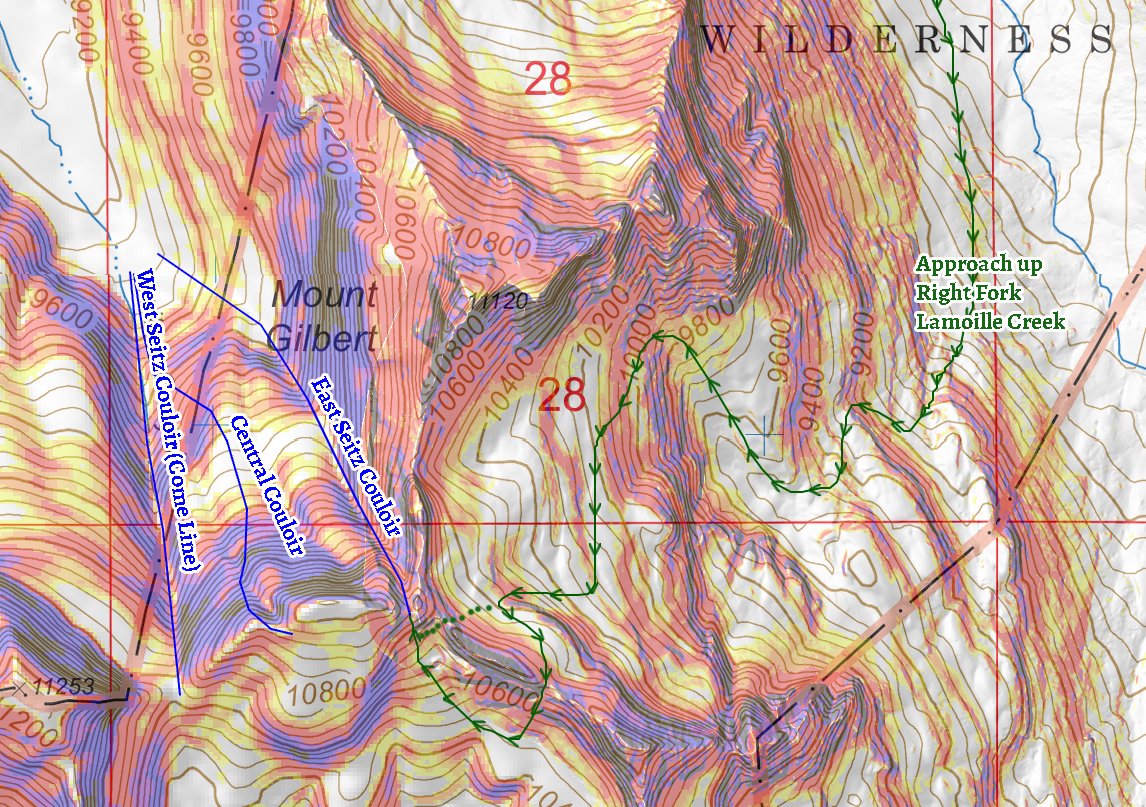
The somewhat convoluted, but recommended, approach is to park at the trailhead for Right Fork Lamoille Creek, and head south down the drainage. Stay focused on the day's objective, and try not to stare too hard at the impressive north face of Mt. Gilbert. Save it for another day, it will still be there. Schuss through aspen groves and past rushing alpine streams until you reach the backside of Mt. Gilbert. There, follow a snaking path (see map in photos below) of mostly low-angle terrain all the way to the southwest corner of the uppermost bowl. Above you rises a large rocky bluff. You have to make your way around this obstacle, and either way will work. The climber's right route is steeper, a little technical, and more exposed. The climber's left route is slightly longer and rolling. Once around this rock outcropping you are essentially at the top of the East Seitz Couloir. After skiing one or all of these glorious lines make your way back to this notch, and simply retrace your steps, skiing between cliff bands for a couple thousand feet all the way back to the creek.

Climbing up the backside bowl south of Mt. Gilbert can be a little wonky, but trust your intuition (and a good map), and you will be fine. Of the three lines the Central Couloir is the only one with features worth pausing for. Take a look at the photos below to see the constrictions and lower elevation cliff bands.
Make a weekend out of it and pack supplies for an overnight back to Echo Lake. Hard to imagine a more scenic campsite, and you have endless skiable terrain in every direction.
