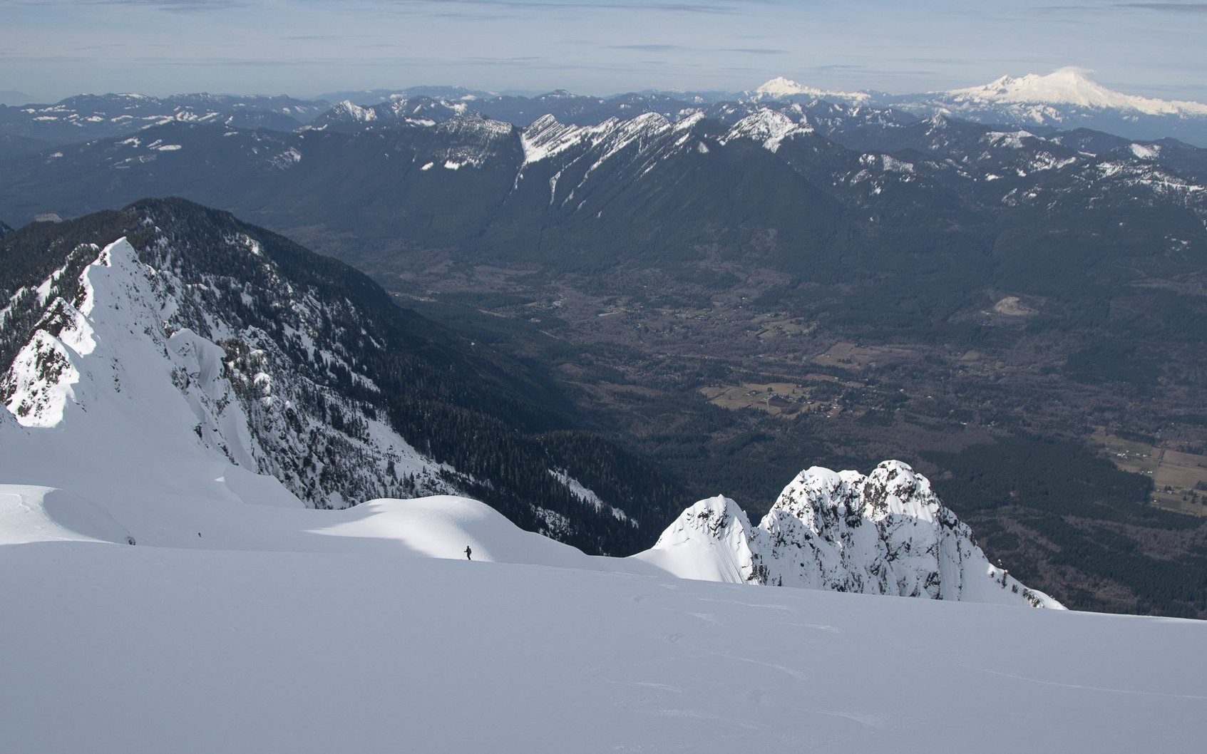
Whitehorse Mountain is a prominent peak that looms large over nearby Darrington and is a classic because of how visible it is from the town. The So-Bahli-Ahli Glacier is the normal ski line off the peak, with an incredible position and views. From anywhere in town, Whitehorse towers above, tempting skiers and climbers to ascend its slopes. On the mountain, you can look down on town, feeling as if you are looking down from the heavens.
The climb up Whitehorse is long and you will likely start on dry trail, but it’s well worth it once you are up high looking down on Darrington and the Mountain Loop region. The ski descent is wonderful and low angle (with the exception of the summit block), but keep your eyes out for crevasses to hop along the way. The vertical relief of Whitehorse is striking, 6,000’ straight up from the forest below. The route is best done in a long day with an early start to avoid warming later in the afternoon. As mentioned, you will likely start your day hiking in the dark in either trail runners or boots, and later transition to skinning. The approach has a bit of ‘shwack to it, which gives it a very “Cascadian” feel.
Most parties can complete the route in 12-14 hours from the car. The approximate statistics are 13 miles and 6,400’ of vertical gain. The slowest part of the day is by far the bushwhack through the slide alder.
The best time of year to attempt Whitehorse is February-April, especially after a low-elevation snowstorm. There have been some years when the entire bushwhack has been covered with snow! I would highly recommend waiting for a high pressure window to attempt Whitehorse, as navigation in low visibility would make this objective very challenging.
The approach begins at the Neiderprum Trailhead just outside of Darrington. You will hike on flat trail along an old forest road towards Snow Gulch. From Snow Gulch, the route climbs up a creek towards a steep ridge trending SW. There are two variations of the climb at this point, one on climber’s left of the waterfall through slide alder, or one on climber’s right on slabs. Depending on the year and conditions, the right hand side can be preferable to the slide alder.
The bushwhack begins at around 1,100’ and ends at approximately 2,200’. If you take the climbers left hand side it has 3 distinct sections. For the first 150-200 vertical feet, you will climb steeply through downed alder and brush. It is thick and the slopes are mostly loose dirt and roots. If you are lucky, you will be able to follow old footprints and tracks from previous skiers. If not, simply maintain the ridgeline.
Once you are through the low alders, the brush transitions to downed trees and thick brush. It is amount the same amount of fun as the alders. With your skis on you will likely have to push and duck underneath branches at times.
Finally, around 1800′, the ridge opens up to larger trees. It does not make the climbing any less steep, but slightly less treacherous. The footing is still mostly loose dirt and roots, but much easier now that you are not thrashing your way through alders and downed trees. From here, you will need to switchback your way up the drainage until around the 2600′ contour, where you will want to traverse to the E across another ridge to enter the Whitehorse drainage proper (Ashton Creek drainage). Proceed with caution through this area; it is a steep gully, and in poor snow conditions can have overhead slide hazard.
Once you have crossed over the ridge you will have sight of the So-Bahli Ahli Glacier and the rest of your climb up. There are a few steeper sections higher up on the glacier where you will want to boot, but for the most part, the route is skinnable. There is a steep rollover at around 5,600’ that can be icy at times. Once above this, you will have nice gradual slopes all the way to the final summit block.
The summit block itself is the steepest part of the climb and can be quite firm depending on conditions. It tops out just above 50 degrees or so, so you may opt to downclimb it, depending on your comfort level. People often will rappel off on a snow bollard in the right conditions, or bail on a picket. It is certainly skiable and there is good runout in case you fall, but it is steep.
The crux of the route is the objective hazard throughout. The entire uptrack is in a huge avalanche prone zone, so get an early start to avoid the chance of large slides due to warming through the day. There are many crevasses throughout the So-Bahli-Ahli Glacier, as well as seracs and rockfall from the subpeaks above. Additionally, the summit block can be a tricky point for some people. It is steep and can become either firm snow or ice, so many opt to rappel it instead of skiing.
The old growth forest around 2,500' is a great place to stash shoes or any other gear you may not need for the way up! Lighten up your load and grab them on the way down.
