


IMPORTANT: This line, and surrounding terrain, are part of the Flathead Indian Reservation's Mission Mountains Tribal Wilderness. Any non-tribal individuals seeking to recreate on this land must purchase a day-use permit in advance (can be done online). Please, respect these regulations, and expect to be ticketed if you try to ignore them.
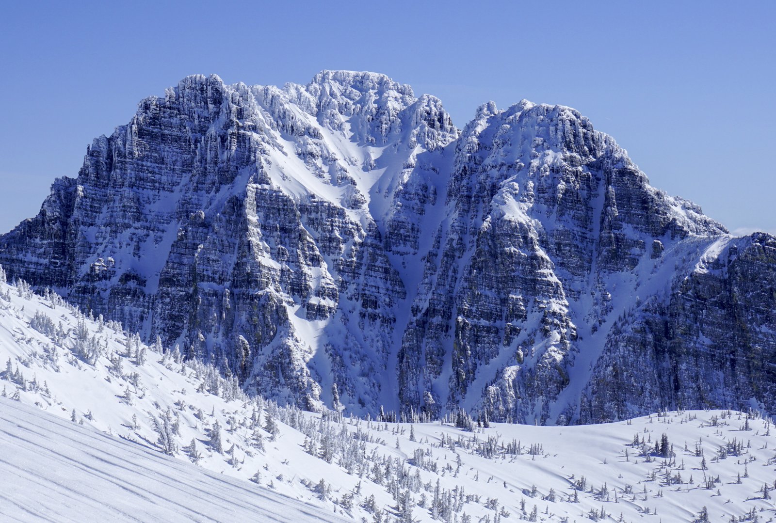
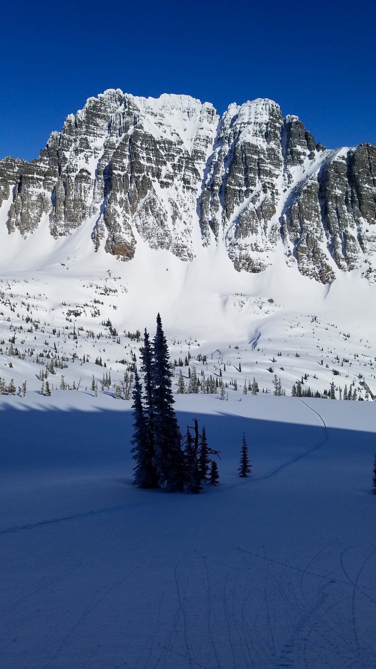
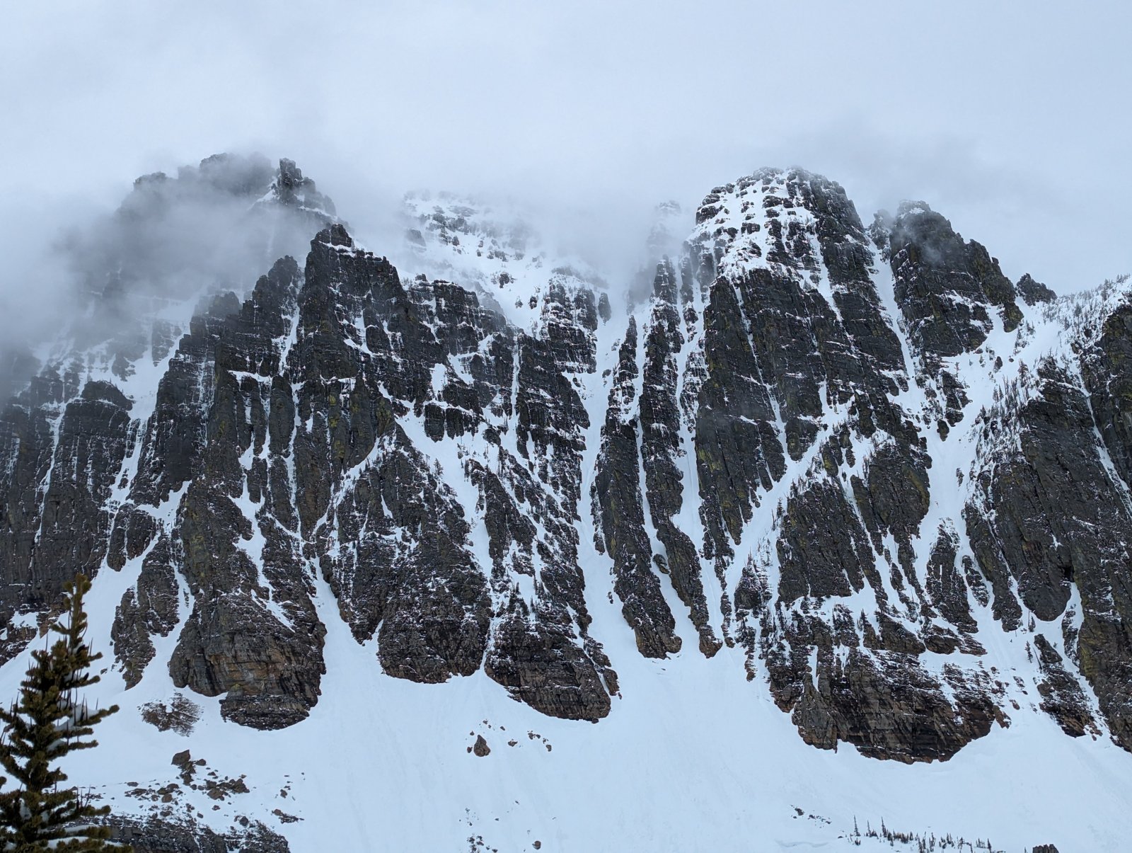
A western Montana classic. This is one of those lines that you see a photo of and it immediately bores a hole deep into your brain, tickling your inner ski tourer consciousness until you just have to scratch the itch. The southern anchor of the Mission Mountains high peaks, Gray Wolf Peak is a downright awe-inspiring piece of geologic wonder. Dripping with lines, the peak is a skier's dream. Couloirs plummet off of nearly every face, including at least four or five on the west face alone (Thumb Couloir, Finger Couloir, Summit Face, etc.).
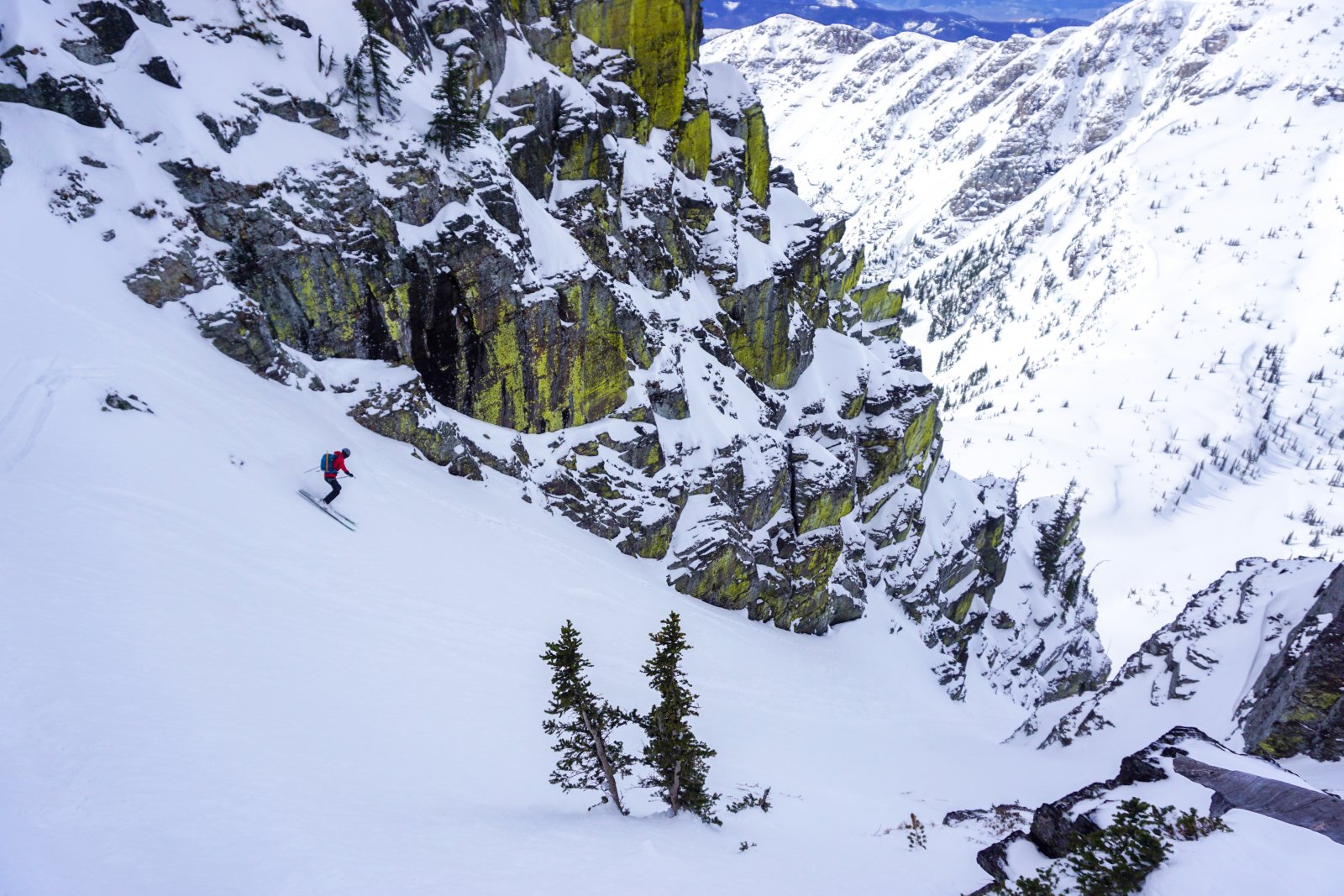
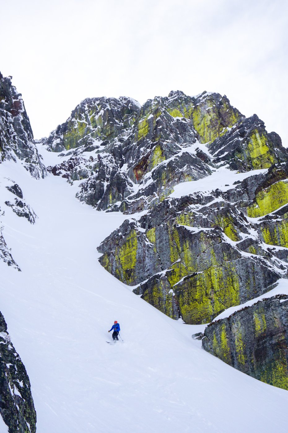
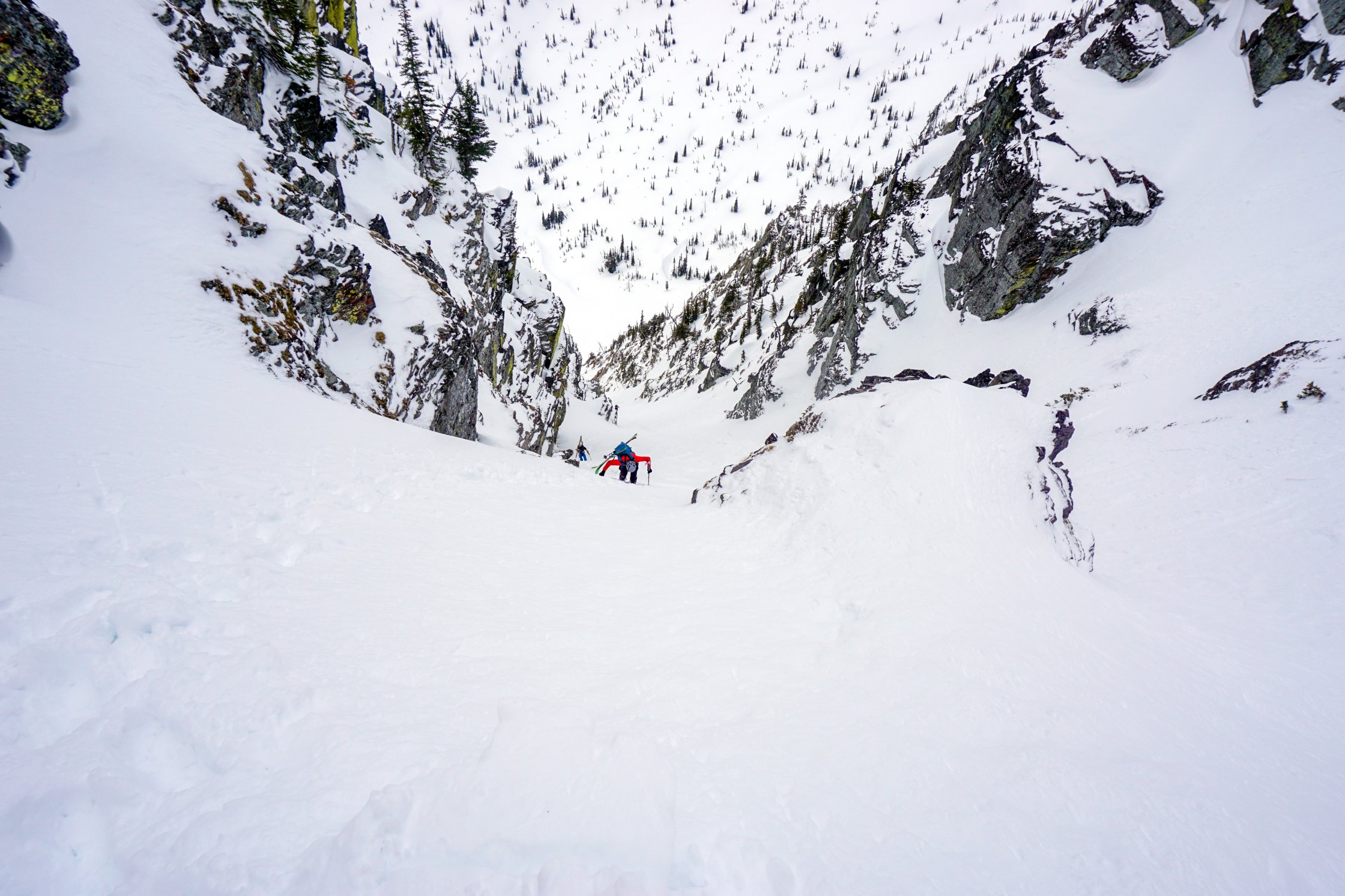
The West Couloir, however, takes the cake. Splitting the mountain in half it plummets 1,700' feet down into No Fish Lake Basin. The line is not as crazy steep as it looks from across the valley when you first view it. But, it is certainly steep enough to be taken seriously. Don't let your guard down, this line has lots of hanging snowfields feeding into it, and can become dangerous when things start shedding. As the spring season progresses it can get very runnelled, best skied late winter. The top of the line is a kitchen table-sized flat spot, perfect for transitioning and taking in the views. The West Couloir is also noteworthy for the fact that the top seamlessly transitions into the almost as dramatic East Couloir.
This line does require some effort. At a minimum if you approach, ski the line, and exit, you are facing roughly 8,000' over 7.5 miles. From the town of St. Ignatius head southeast along Dry Creek. During big snow years this road can be snow covered and sometimes impassable. Best to plan ahead, prepare for a long flat pre-approach, and always park somewhere where you are not blocking others or violating private property rights.
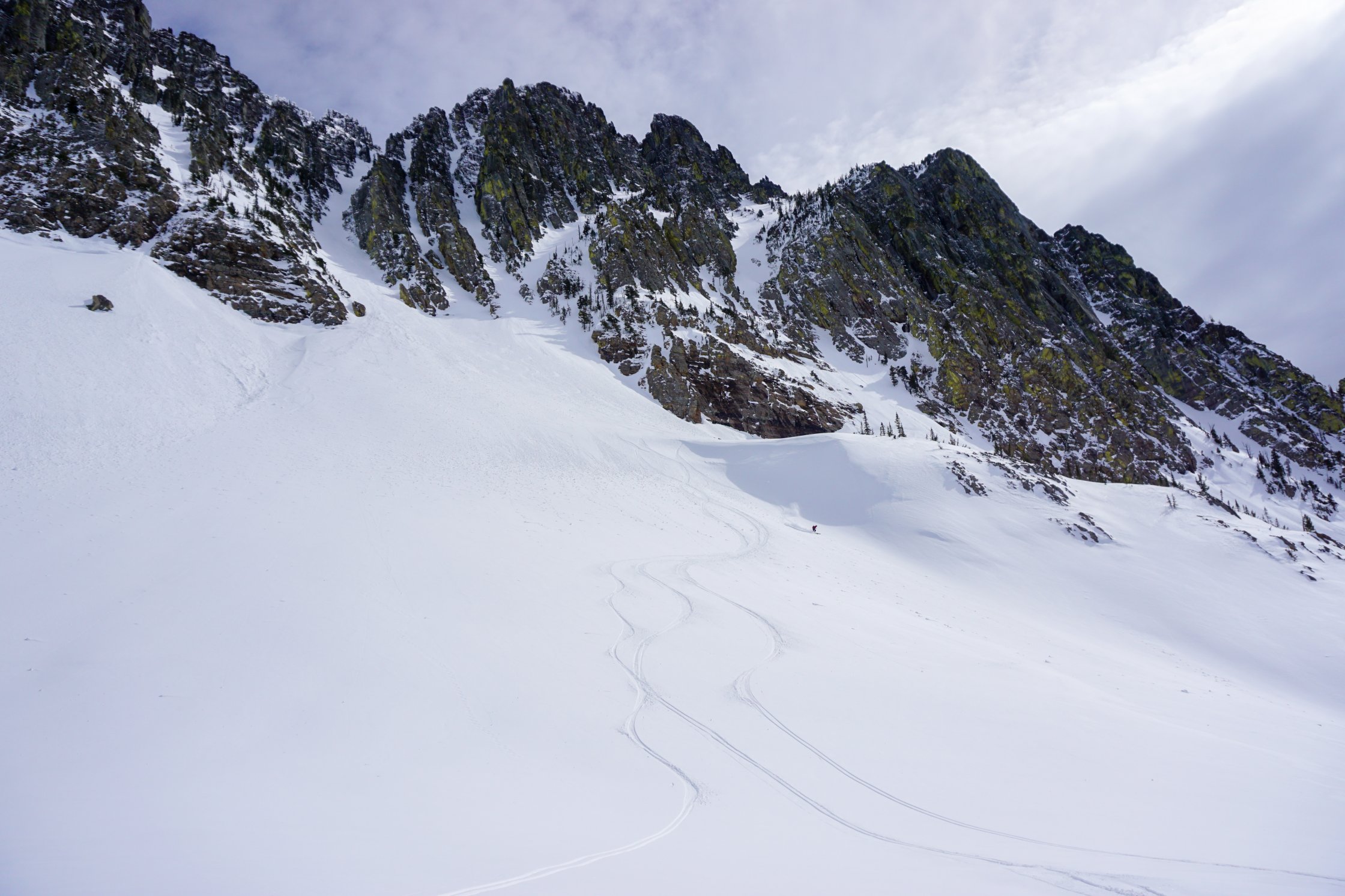
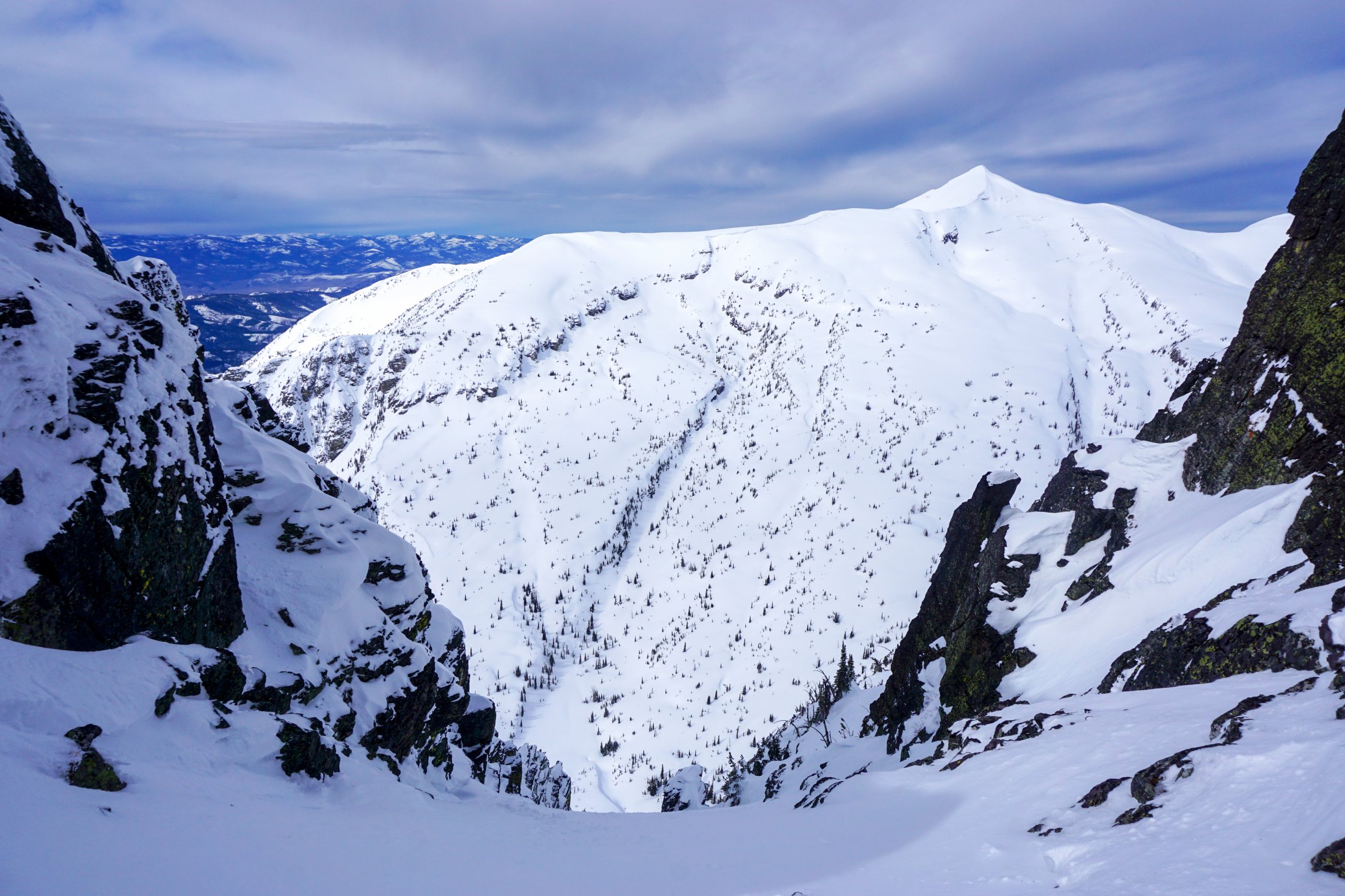
Typically, your tour begins at the parking area (marked as a campground on topo maps) on the west end of St. Marys Lake. Poke around in the brush until you find the climbers trail that leads straight up the ridge that forms the southeast wall of Power Creek. No joke, this trail goes straight up. You gain 4,600' in the first two miles, let that sink in. As you pass tree line and surmount the final push to East St Mary Peak's south ridge all will be made clear. The terrain to the east slopes gently down into the stunning No Fish Lakes Basin. Across the way is your objective, it should be obvious. Enjoy an almost 1,700' foot casual descent to the base of the couloir before skinning then booting it to the top. Reverse your steps on the way out.
If you would prefer to get more of a skier's line instead of the approach ridge on the exit, then drop into the south bowl at the top of the climb leaving No Fish Lake. Just be aware that this drainage is steep-walled and very brushy the further you go down. You will have to traverse skier's right back to the climbers trail at some point. This can end up being schwacky at best, heinous and sketchy at worst.
Given stable and safe general snow conditions in the line itself, the crux of this route is literally the quad crushing hiking required up and down the climbers trail. Also, be heads up when ascending and descending the line in regards to the hanging face that feeds in from the true summit. This face can get more sun than surrounding snow patches.
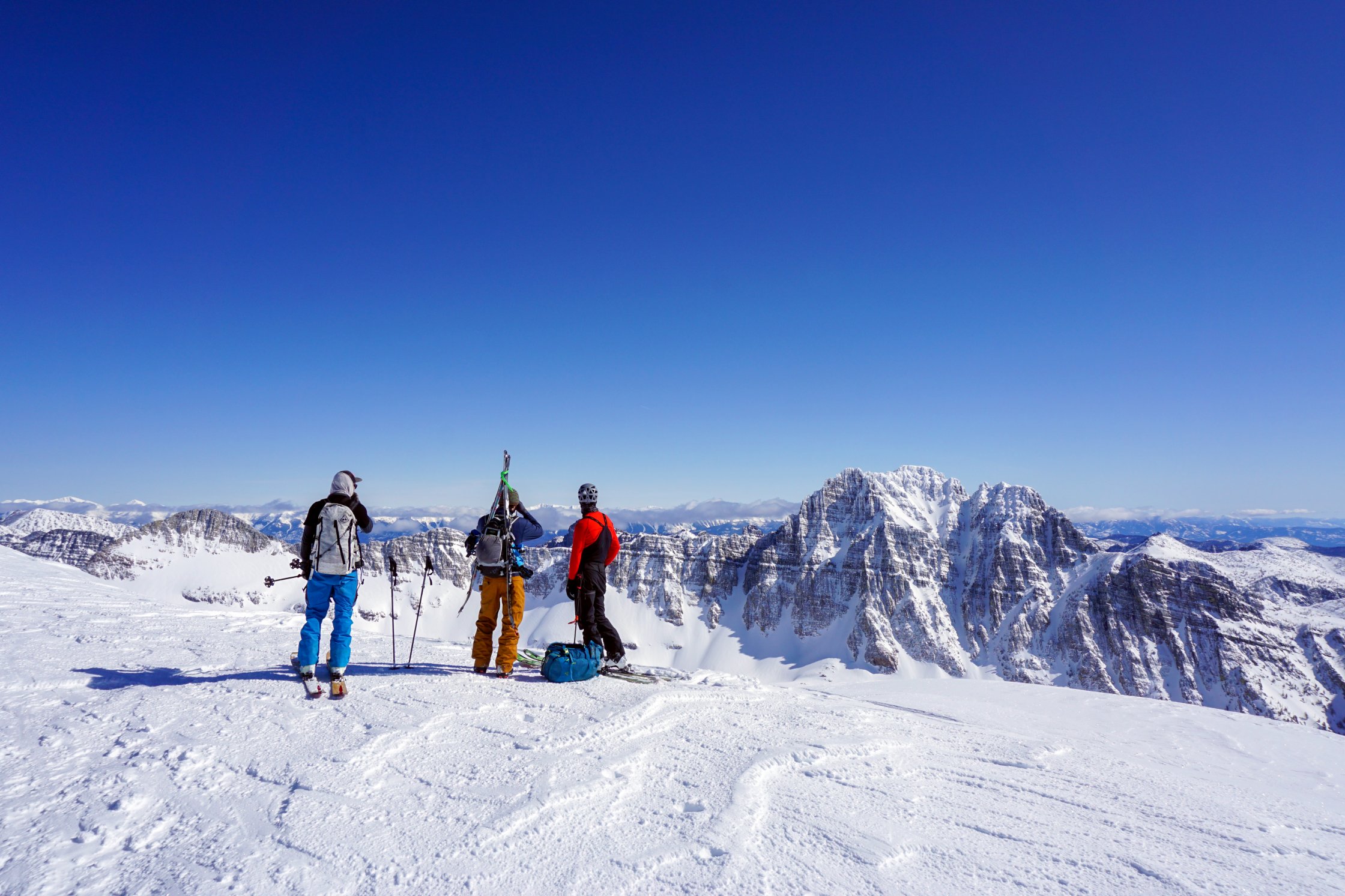
It would almost be a shame to work so hard to ski this line, and not bother skiing its twin beauty, the East Couloir. A recommended tour is to follow the approach described above, but simply drop east from the top of the West Couloir, skiing the slightly shorter, slightly steeper, and equally splitter East Couloir down to Scenic Lakes. Boot back up and ski the West. For those looking for a fitness challenge, local ski legend Brian Story holds the speed record for this route, currently 4 hrs 20 mins 20 secs.
Also worth mentioning, the Mission Mountains are home to a healthy grizzly population. If you are heading out in the spring it would be wise to bring bear spray along (and know how to use it).


Justin D
04/29/2024 2:16pm
(Skied 4/28/2024)
Long day but well worth it
Gear I used
2023 atomic hawx ultra xtd 130
ATK Raider