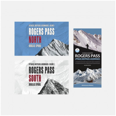
It’s hard to overstate the backcountry skiing terrain of Rogers Pass, British Columbia. Think massive faces, steep couloirs, great tree skiing, terrifying yet enticing avalanche slide paths, and playful pillows. Oh, and it’s all covered in legendary interior BC powder. Thanks to Douglas Sproul, it’s now also hard to overstate the area’s guidebook. Rogers Pass is a complex area but Sproul's incredibly helpful aerial photos and succinct descriptions enable you to easily dream up your ideal ski day. After one trip, US citizens might just find themselves looking for a Canadian spouse in order to get a green card and live out their days on the pass.
The guidebooks are a two-part volume with the Trans-Canada Highway dividing the region into north and south areas. The waterproof, tear-resistant map gives a high-level view of the entire region.
- An objectively beautiful book featuring spiral binding, full-color photographs, and custom maps.
- Covers winter permit system, area closures, National Park regulations, huts, GPS coordinates, and other crucial info specific to touring Rogers Pass.
- Best routes, dangerous areas, and notable features are highlighted on photos.
- High-quality spiral bound book.
- 216 pages north guidebook and 264 pages in south.
- Release date May, 2021.
- 273 routes (both books combined)
- Map dimensions: 38” x 27” (folds to 4.25” x 9”) and scale: 1:42,500 with contour interval: 20-metre
- Expensive, but worth it. We promise.
Related Products
Questions & Reviews
Unfortunately, we cannot get this guidebook at the moment.
The Ski Guides do not come with the map, it is sold separately.
Earn store credit by writing reviews. Learn more.


