2/16/2022 WURL on Skis
By Matt Randall
Earlier this month, Matt Randall completed an impressive one-day push of a ski traverse that roughly mirrors the WURL - a legendary summertime scrambling route in the Wasatch. But instead of just sticking to the ridges, he added in some fun (and spicy) ski lines along the way. We were curious about where exactly he skied and how it went, so Matt generously wrote up a trip report for the blog. Enjoy!
-------
When I moved to the Salt Lake area in January of 2021, I was vaguely familiar with the WURL - a legendary 36-mile scrambly, horseshoe-shaped route that traverses the alpine ridgelines around Little Cottonwood Canyon. But since I’ve never been much of a runner, I never thought too much about it. However, as I skied more in the Wasatch, the gears started turning in my head when I imagined doing a winter version of the WURL on skis. It was always more of a pipe dream, something I thought would be really cool, but wasn’t sure if conditions (personal and mountain) would ever align for an attempt. I’ve always enjoyed trying to link ski objectives, so a WURL on skis seemed like a logical progression, just on a larger scale. The seed had been planted.
Fast forward to this winter where a good amount of early snow allowed the deep persistent weak layer to heal by mid-January. On top of that, a prolonged period of high pressure meant that while the conditions might not be the most fun to ski, a majority of terrain was game on stability-wise. I also randomly did a single-day push from Broads Fork to Twin Lakes Pass for fun and realized afterward that I already had almost half of the route locked down. Things were aligning nicely and the seed was now sprouting.
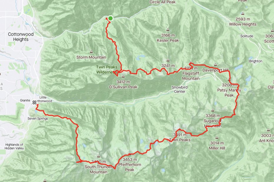
Time: 26:50
Vert: 21,600’
Distance: 35+ miles
Next up was determining the ethics and style that I would approach this route with. I decided to ski as many “real lines” and prominent peaks on the WURL ridgeline as possible. I was not about to scramble up a peak to then scramble down it - I’m a skier, so I want to ski, dang it! Someone a little more masochistic than I will surely repeat this and stay ridge proper… and I do not envy them one bit! That would be one hell of a sufferfest.
To prepare, I found a blog post on Jared Inouye’s blog, SLC Samurai, and read about his attempt at a WURL on skis in 2010 with some O.G. SLC crushers: Jason Dorais and Bart Gilespie. I also watched the movie made by Salomon of Mali Noyes and Lani Bruntz’s WURL on skis adventure in 2020. Both Jared and Mali were very supportive and excited to answer my questions and help guide my proposed route. Jared’s party stayed very true to the ridge for the majority of their effort it seemed, but cut out the section of ridge from Superior to Hidden Peak, due to resort regulations. Mali and Lani’s adventure took an approach closer to mine, I think, by hitting high points on the ridge and then skiing off of said high points, but not spending too much time on the ridge itself. To my knowledge, neither party had skied Lone Peak at the end.
I had initially planned to bivy overnight and make the ordeal a two-day outing. However, as my proposed start date approached, I decided a single push would be better. Realistically, I figured I wouldn’t get much rest anyway and would rather bring less gear and simplify the plan. I wanted to go solo and unsupported and figured there were plenty of bailing options in case I had second thoughts. I put together a packing list and planned out my food, focusing on lots of simple sugars and a little bit of “real food.” With everything packed up and ready to go, all I had to do was get ‘er done!
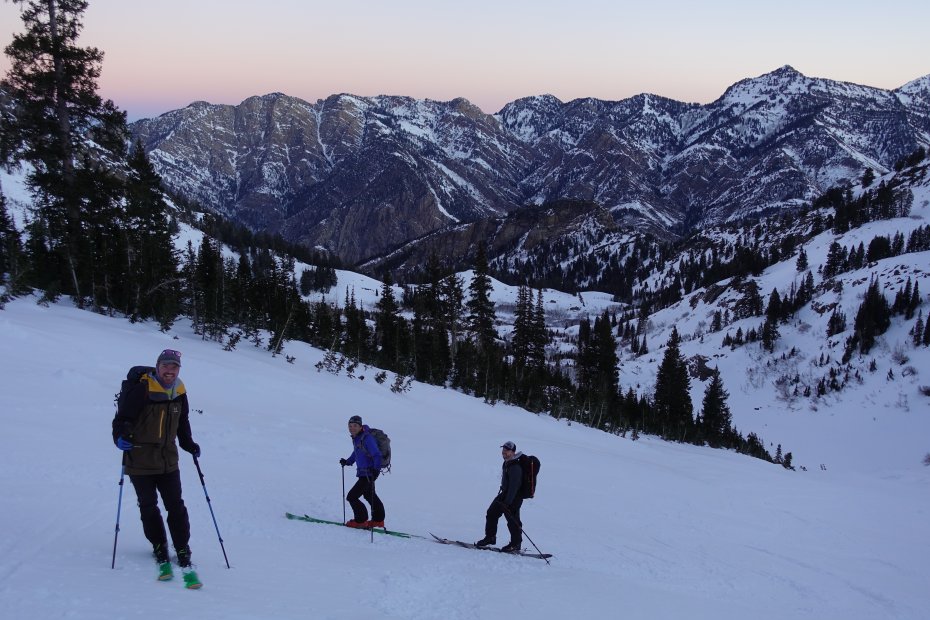
Sunday, February 8th at 5:35 am, I departed Broads Fork Trailhead alongside 3 friends: Pat Gibbs, Mike Peterson, and Jake Benda (technically, I was not alone due to this, but I still consider this a solo endeavor since I broke trail to the summit of Twins Peak ahead of them and parted ways with them at the top without having received any food/water/etc). Although I didn’t receive physical support from my friends, it was really nice to enjoy their company and joke around about how dumb I was for doing this. The day started on a very positive note.
Arriving at the summit of Twins Peak in around 3 hours and 40 minutes, I looked to the east and south to take in the views of the route. I felt somewhat nervous for what I still had in front of me. Having skied the East Face the previous weekend, I knew it went (albeit thin). Saying goodbye to my buddies, I dropped in. The snow was firm and “loud,” but being a skier from Colorado, I felt at home. Three minutes later I was down and transitioned to head up towards Dromedary Peak.
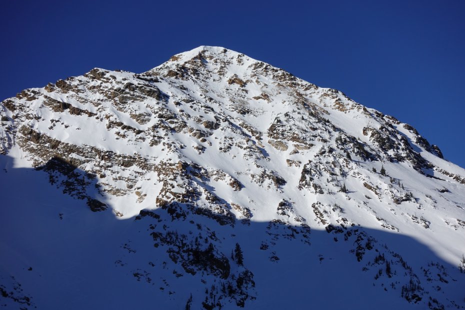
As I was topping out on the ridge that separates Broads Fork and Mill B Fork, I could see my friends descending the East Face. I wrapped around from the ridge to the east of Dromedary peak and decided to ski down ~200’ short of the summit. It was rocky and considering the trip’s style goals, it didn’t make sense to summit.
I skied eastward down a large gully until it met up with the north-facing line, Yer Crazy (aka Athey’s Line), and skied the bottom half of it in pretty good condition. From the bottom, I skinned towards the Sundial Peak Ridgeline. I had found a nice little couloir off of the ridgeline the week before, which offers a nice alternative to going down and around the entire Sundial Peak feature. After a 15’ downclimb, I jump turned my way down the tight sections of the couloir until opening up some turns at the bottom. Shortly after exiting, I once again transitioned to head back uphill.
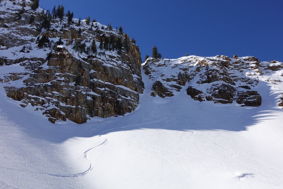
I skinned up into the Monte Cristo Cirque and traversed into the smaller cirque directly to the north of both Monte Cristo and Superior. After gaining the ridge between the two peaks, I followed it to the summit of Superior and noticed it was devoid of human life…on a Sunday. I guess I don’t blame people for not wanting to ski when conditions are sub par, but having Superior to myself was a new experience! I skied Cardiac Chute down until it ended and then made a hard traverse to the east, trying to save what elevation I could. It worked and I managed to only need to skin a few hundred feet to get up to Cardiff Pass.
Recently, I had scrambled the ridge between Cardiff Pass and Flagstaff Mountain. It wasn’t bad scrambling the rocky parts, but the snow had been warm and soft, so the booting had been a pain. Since there was a stout breeze all day, I decided the south-facing terrain would offer fast skiing and booting. I chatted quickly with a woman named Samya who was waiting on some friends and then started traversing east on the south-facing terrain.
Under Flagstaff Mountain, I stopped and decided I might as well take advantage of the sunny weather and whip out my MSR Reactor stove to refill my 1.5L Camelbak, which I had already slurped down. I enjoyed myself a peaceful little lunch with views across Little Cottonwood Canyon. There was still such a long way to go…
After the little pit stop, a well-trodden bootpack granted me access to the top of Flagstaff quickly. The weekend prior, I had dropped from Flagstaff into Days Fork and then gone up Hideaway Park to drop into Silver Fork. This time, I decided that those lines weren’t really worth skiing and didn’t add much value to me, so I decided to instead traverse east straight towards Twin Lakes Pass.
I was able to ski traverse all the way to the flat spot where “Chad’s Gap” is and got to Twin Lakes Pass pretty quickly. From here on out, probably 80% of the terrain was completely new to me. On one hand, I was excited to have made it to my end point from last weekend and still feel really good and be making good time. On the other hand, I was nervous and anxious because I knew my daylight was running out (~3 hours left) and there was a lot of new terrain in front of me.
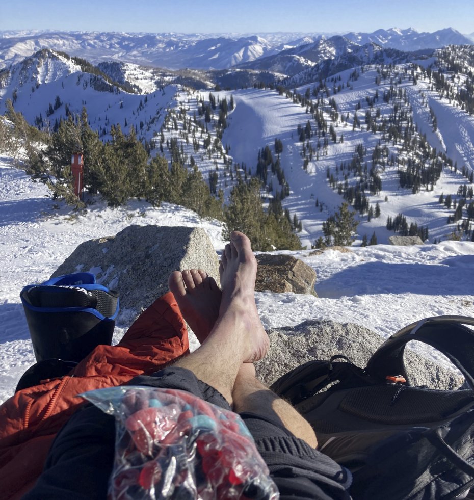
The climb up to Patsy Marley and traverse over to Mt Wolverine went easily and I decided to take a moment to care for my feet before the sun set. I changed my socks on top of Wolverine and enjoyed some of my favorite ski snacks: “Very Berry” gummy worms and “Berries n’ Cherries” Welch's fruit snacks. Letting my feet breathe for a bit and fresh socks ended up being a very crucial move for me, as my feet were getting quite tender and my socks were a bit damp.
Around Alta and Snowbird, I knew I wasn’t allowed to go uphill on their property. So from Mt. Wolverine, I made the most direct route to Catherine’s Pass and stayed on the other side of Alta’s “Ski Area Boundary” signs. I was able to take the ridge most of the way towards Devil’s Castle and then took a tight chute to the southeast before regaining a neighboring ridge. The tight chute had a short straight line segment that I pointed through and barely held it together! Once I stopped after skiing through it, I saw that one of my boots had popped out of ski mode. Or, more likely, I had forgotten to put it in ski mode in the first place… Doooohhhhh!
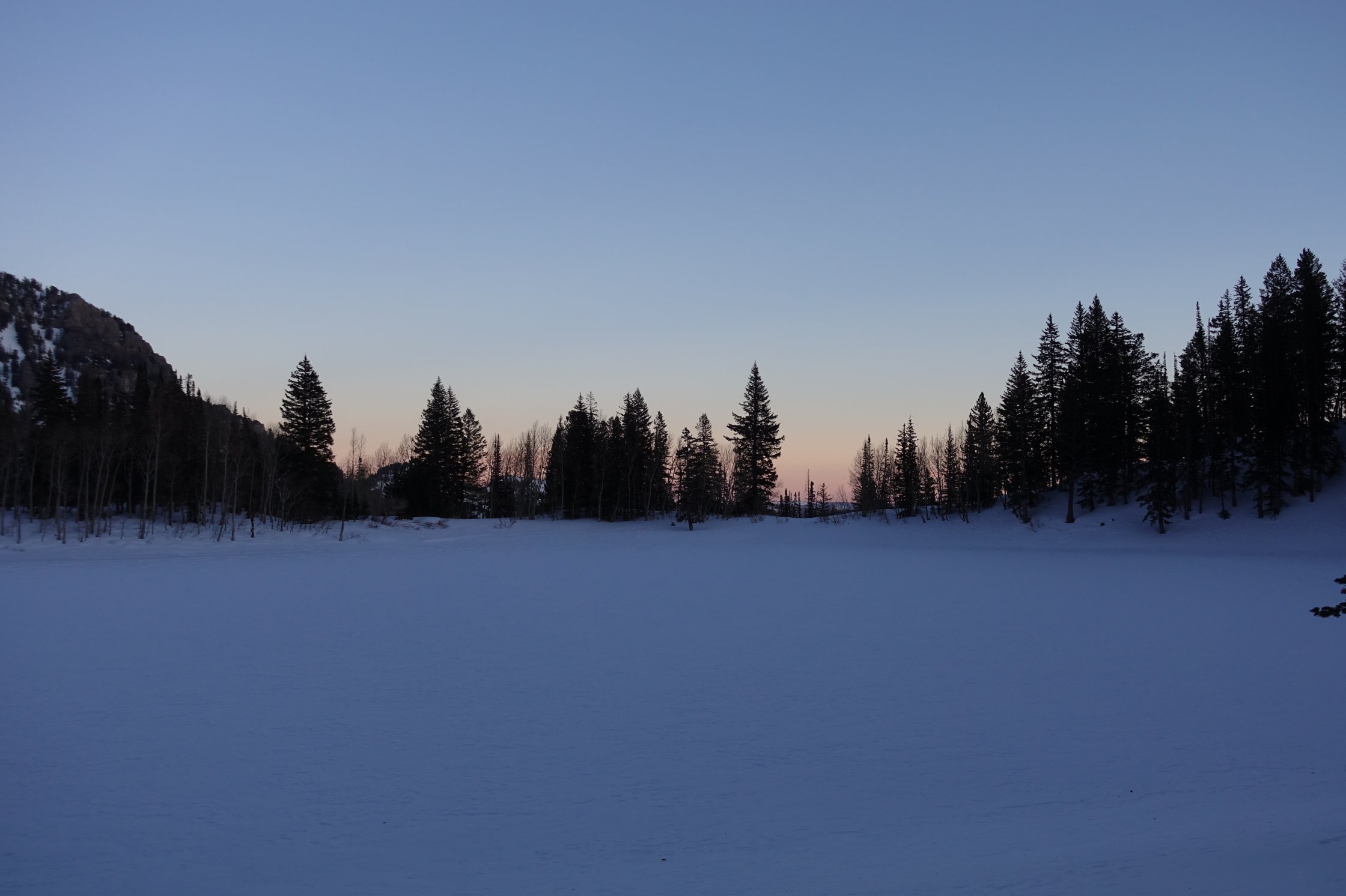
After gaining the ridge to the southeast of the high point, I made my way down and west towards Pittsburg Lake, on a line that I believe is called “Smugglers.” I then took advantage of the dying light and navigated a few cliff outs. At Pittsburg Lake, I admired the sunset colors to the east across the lake. Little moments of beauty like this are a big reason why I love this stuff.
To the south of Pittsburg Lake, I tried to ski traverse to the west again, but was cliffed out by some huge features so had to backtrack a bit. Luckily I had some final light of the day to get me past this crux. Had I been skiing by headlamp I may have tried skiing down something that didn’t go and had quite a time getting back up and finding a way.
Once in the drainage south of Pittsburg Lake, the next goal was to get up to “Sinner’s Pass,” which is to the southeast of the Mineral Basin area of Snowbird. Darkness had fully set in, but luckily the moon was bright enough to allow me to travel by moonlight and conserve headlamp battery (I had brought two headlamps, but I figured it wouldn’t hurt to have more life in the headlamps in case sh** hit the fan). I ran out of water at some point during this climb and made a mental note to brew up water again soon, and loosely made a goal to get into White Pine drainage before stopping for that.
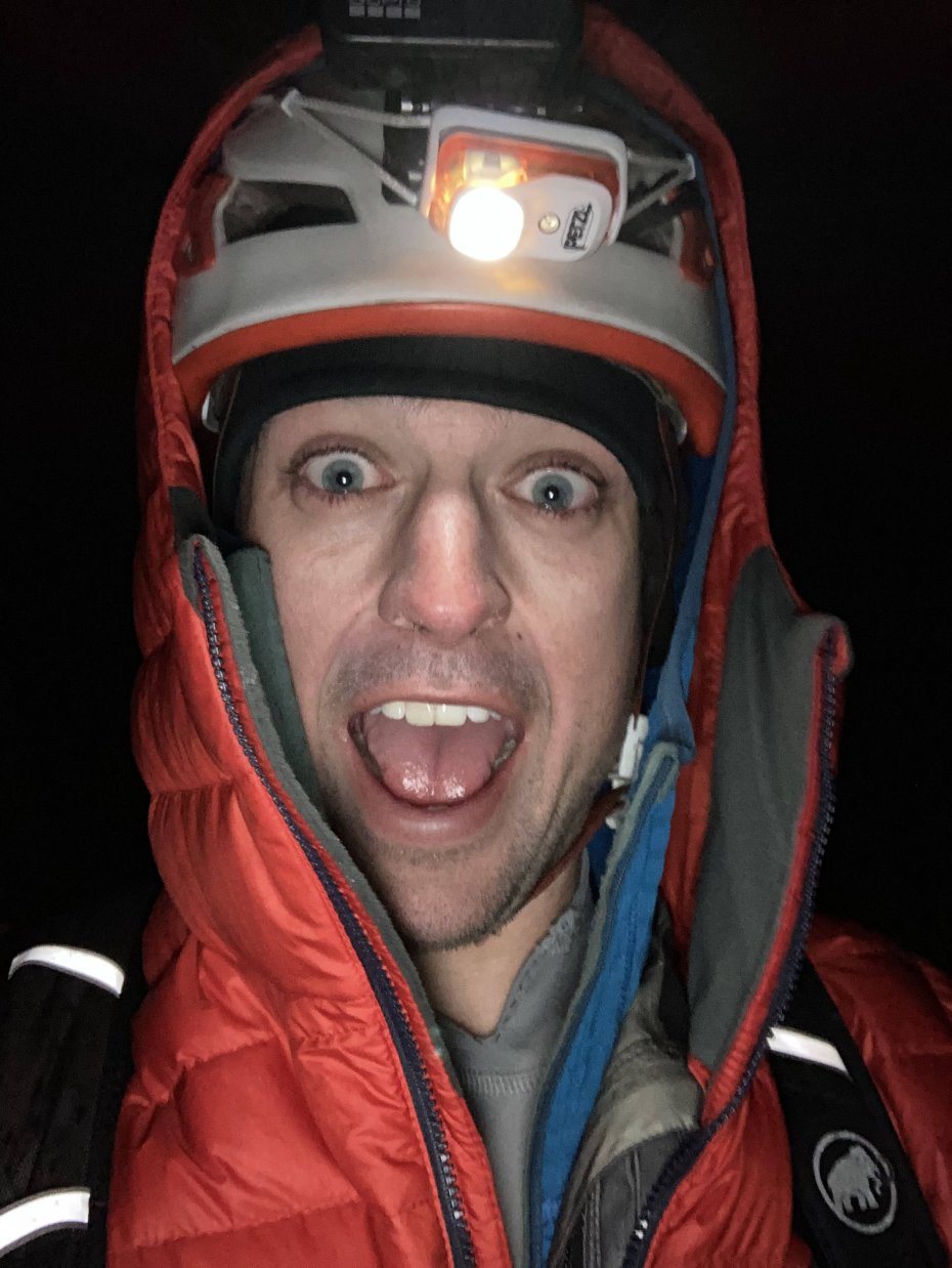
With night in full swing, the temperature dropped and the constant breeze now felt like an icy wave penetrating all but my thin La Sportiva shell jacket. I mentally thanked “Past-Matt” for hooking up “Future-Matt” by changing his socks (sometimes I love that guy!). The darkness was a bit unnerving. I wasn’t on terrain that was “gnarly” or anything, but simply being in a new area without visibility felt spooky. I wouldn’t say this is necessarily an irrational feeling, as I wasn’t in any true danger, I just didn’t feel fully comfortable.
Everything had been going extremely smooth up to this point. On my way up the Mary Ellen ski line towards the saddle between Twin Peaks (American Fork) and Silver Creek Peak, I decided that stopping on a 30 degree exposed slope was a great place to take a break and brew up some water. As I was unpacking my bag and prepping, I dug out my Arcteryx synthetic down pants to put them on. Similar to my high school days on the gridiron, I fumbled the hell out of the pants and had the pleasure of watching them tumble down the refrozen slope until they faded from sight into the dark. Cursing my lack of motor skills at the moment, I began the process of melting water and soon realized that the gas in my canister was too cold to produce a strong flame. My plan was to melt a little bit of snow so that I could then dip my gas can into the water, warming the gas enough to get a good flame, and then melt and boil more water. To my dismay, the wind extinguished the stove and I was unable to get the flame lit again. Well, shucks. I unscrewed the canister from my stove, shoved the cold canister under my jacket, and packed up. I was chilled to the core and began busting a$$ up to the saddle to try and warm up.
From the top of the saddle, I traversed to the top of Twin Peaks (American Fork) and ski traversed down to “East Pass,” a col that gains access to White Pine drainage. While skiing into White Pine, I found out the hard way that skiing in the dark with my headlamp on the lowest setting isn’t a good tactic. A rock “came out of nowhere” and I did a nice over-the-handlebars, luckily just into snow and not more rocks. Lesson learned, little to no headlamp power on the up is totally fine, but skiing with a headlamp on the low setting is just silly.
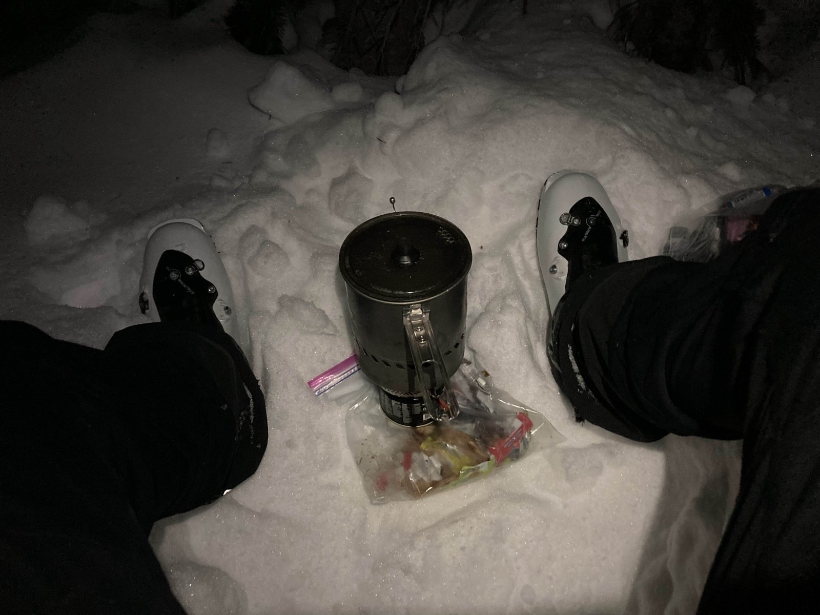
Before heading up to White Pine Lake, I found a nice pocket of trees and figured that my body temperature had warmed up my gas can enough to finally boil some water. Thankfully, the trees protected me from the wind and my stove was able to make a strong flame. I also ate some more of my homemade quesadilla (with salami, avocado, and mucho queso) and enjoyed more gummy worms and fruit snacks.
The skinning up to White Pine Lake went by quickly and soon I was getting blasted by wind again as I booted up Lake Chute. I had done a quick tour up Lake Chute with my aforementioned buddy, Pat Gibbs, a few days prior so I decided to descend into Red Pine that way because I knew the booter was good and there was legit skiing on the other side. At the top of Lake Chute, I went up to the north summit of Thunder Mountain (as per GAIA) / Lake Peak (as per Wasatch Backcountry Skiing). Sorry for my ignorance with the peak’s name… show mercy, keyboard warriors!
Skiing into Red Pine drainage was simple and soon I was gaining the ridge between White Baldy and No Name Baldy. The wind was a pain in the arse on the ridge, blowing snow from in the basin right into my eyes and stinging my cheeks. Nothing crazy, but definitely annoying. Even though it was only 50’ above me, I decided to traverse to the south of No Name Baldy, for two reasons. First, it is called No Name Baldy, so it can’t be THAT important… Right?! And second, it gave me a nice little reprieve from the wind on the ridge.
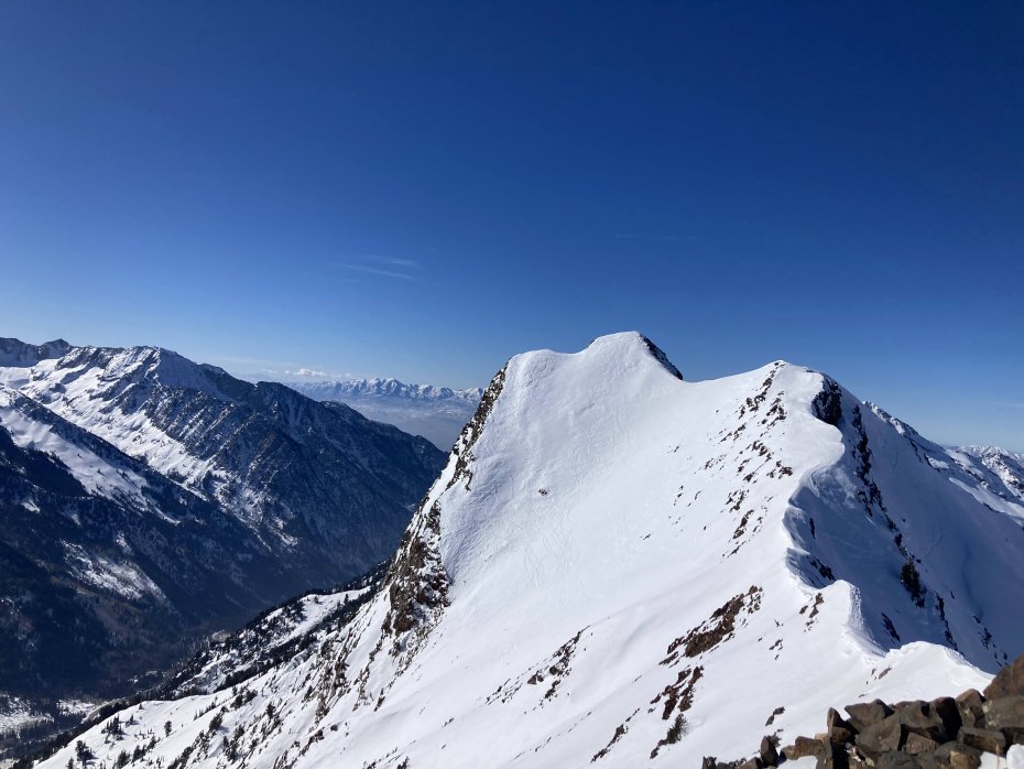
I traversed to the base of the east ridge of Pfeifferhorn and followed one of the most convoluted bootpacks to the summit. There seemed to be 4-5 different bootpacks within a few feet of each other, and each one was very shallow and still required a lot of effortful front pointing. Not to complain about a “bad bootpack” that I didn’t put in (those people annoy me), but it just seemed funny to me that instead of everyone using a single bootpack and breaking it in properly, folks decided to instead make multiple booters. Sorry, rant over. I greatly appreciated each and every bootpack and skinner that I used during this, so thank you to all of you anonymous, unsung heroes.
I had hopes of skiing the NW Couloir on Pfeifferhorn, because it’s a super fun line and mega aesthetic, but I wasn’t about to carry a rope, harness, and gear all this way for the rappel. I had asked a few folks that had been on it recently what they thought about the feasibility of a downclimb of the main rappel. I had rappelled it twice before but had never looked at it with a climber’s eye. Ultimately, I decided that to onsight downclimb the rappel in NW Couloir after a full day of movement, in the dark, was absolutely out of the question. Instead, I hugged the ridge on the south side and navigated my way west until I was below the saddle between the main ridge and Chipman Peak.
Skinning and booting up to the saddle near Chipman Peak, the fatigue really started to set in. At this point, I had been moving for pretty much 19 hours straight, so I was actually really happy with myself to be “finally” feeling it.
Looking at the map, I figured I only had 500-600’ to get to the saddle, but it felt like double that. Once there, Chipman Peak was a bit out of the way, only by a few hundred feet, but I decided to forego its summit and ski west towards Lake Hardy and get to Lone Peak as quickly as possible.
I knew that Lone Peak’s NE Couloir was going to be the most exposed and steepest ski descent of the day. Not only that, but I had never skied the line (let alone been in the Lone Peak Cirque), I would be doing it after 23 hours of movement, and skiing it in the dark. I like to think I am good at assessing risk but I’d be lying if I said that skiing the NE Couloir of Lone Peak for the first time after 23 hours of movement and by headlamp was a good idea. But, that was the situation I knew I’d be in, and so I knew I needed to be on point.
With that in mind, the decision to not summit Chipman Peak was an easy one to make and I also decided against climbing up the south face of South Thunder Mountain. I instead just beelined it to the base of Lone Peak. At the bottom, I found a nice little boulder that was sheltered from the wind and had a final snack break. I ate as much of my snacks as I could stomach and took some last looks at some pictures my friends Nick Pearson and Adam Bellomy had sent me from their ski descent of the NE Couloir a week prior.
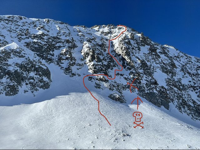
Finding the start of the couloir wasn’t an issue thanks to Nick and Adam’s picture, and soon I was following their faint tracks across the traverse that bypasses some short cliffs. Once in the couloir proper, the snow was a mix of surface facets and small sheets of wind-affected snow. Thankfully the sheets were small and not continuous so I decided that I wasn’t concerned with wind slab issues enough to bail. However, I knew these conditions would make the skiing very demanding and funky.
Booting up the couloir proved to be really hard work and I settled into a rhythm of kicking in 50 steps and then looking up, in hopes that somehow the top would look closer… to no avail. I kept moving to stave off the bitter cold and soon I was navigating the final rocky patch to the summit ridge. I opted to settle for the north summit of Lone Peak instead of going to the true summit and then prepared for what I knew would be an engaging descent. My phone read a temperature of 6 degrees, not sure how accurate a phone is with temperature, but with the wind it definitely felt like single-digit temperature. My time on the top was cut short by my longing for a hot shower and warm food.
I down climbed through the rocky area and put my skis on. Game time. With careful turns,I made my way down into the couloir proper. Each jump turn was punctuated by sharp exhales. As expected, the snow proved to be “funky.” Some areas were supportable and firm, while others parts had my skis break through into the softer snow. A fall here would have been pretty devastating. My attention was solely focused on the circle of snow that my headlamp illuminated. I’ve historically never really been very spooked by skiing steep slopes over cliffs, but I’m sure that if I had been able to see them in my state, it would have weighed a bit on me.
Once in the couloir proper, I still had a large cliff at the bottom that could spell disaster in the event of a fall, so I continued making careful turns. My rhythm turned into making a sharp jump turn, side slipping 10-15 feet, and then making another turn. Admittedly it wasn’t my best skiing style, but it was safe. Soon I was to the traverse and made my way across the top of the small cliff. I was home free, and I knew it!
As I began to ski out of Bells Canyon, I could feel the weight of the whole day fall onto my shoulders. I was cold, physically exhausted, and after that descent, I was mentally fried. Skiing down into the thick of Bells Canyon, I soon realized that I still had a few hours of arduous work to get out. I was still very much in it.
My skiing had gone to crap so I decided that the safer option would be to put the skis on my pack and walk out. Plodding downhill in ski boots always feels so silly, and I’m embarrassed to report I’ve done quite a bit of it. The trail had been traveled pretty heavily, and after a few slips, I decided the crampons were going back on. With traction on and miles of trail ahead of me, I entered zombie mode and cursed the trees as they repeatedly grabbed at my skis A-framed on my pack.
Approximately 26 hours and 50 minutes after leaving Broads Fork Trailhead, I finally arrived at the Bell Canyon Granite Trailhead. Waiting for me were my friends Nick Pearson and Adam Bellomy. Nick brought me some warm food and both offered their congratulations. It was nice to see them, and we all enjoyed some trash talk on the Bell Canyon exit for a few minutes before Nick drove me home. Both Nick and Adam have done the WURL in the summer so they shared my ill feeling on the exit. The Bells Canyon exit was by far the worst part of this whole thing. I was in okay shape by the time I was off of Lone Peak, but exiting Bells Canyon was an absolute slap in the face.
I spent the remainder of the day resting and responding to all of the messages I had received throughout the day, encouraging me and checking in. Knowing I had so many people in my corner was a really cool feeling and made me realize how lucky I am to have such supportive friends.
To the eager and possibly over-ambitious ski mountaineers out there, there is plenty of room for improvement on this and I would be more than stoked to talk over details with you if you are seriously considering giving this a go. My biggest advice would probably be to not exit via Bells Canyon, but I’m not familiar with the area, so maybe Bells Canyon IS the easiest way out…
Thank you for reading this long-winded account. It was my longest continuous adventure thus far and was everything I hoped it would be. I didn’t “find myself” out there and I didn’t realize some deep and transcendental truth about life or anything. But, if I had to put my finger on something that I took away from this experience, it is one of my favorite quotes: “Luck is when preparation meets opportunity.” If you have a pipedream of your own, take steps towards accomplishing it, even if it feels unrealistic. You never know when a dome of high pressure will sit for almost a month over your local hills and present the perfect opportunity to suffer!
Catch you out there!
------------
About Matt Randall:
I was born and raised in Colorado but my love for the mountains didn’t start until the winter of 2015, at the ripe age of 23 years… whoops! Needless to say, I was hooked from the start and my passion for ski mountaineering has taken me to many great places and introduced me to many amazing people. I have skied off of the summit of Pico De Orizaba (naked… but that’s for another time), Denali, and I have done “No O2/No sherpa” attempts to climb/ski 8000m peaks in both Nepal and Pakistan (unsuccessful attempts). I love the skiing in Colorado, and am forever grateful to have learned there, but I long for better access and better winter skiing.
Comments