


Three caveats:
- This review is only for the map of New Hampshire's Presidential Range.
- I might be biased b/c that map started with my own custom gpx file.
- I received some comp'ed maps to give away as prizes for my skimo race series.
Still though, this map is an absolute must-have item for anyone interested in exploring the Presidentials beyond the really straightforward yo-yo standard outings.
Although the map started with my own gpx file, it was heavily supplemented with other sources, including add'l field research. And you're getting far more than just a bunch of tracklogs superimposed on a topo map: the supplementary text boxes are all highly informative.
(Maybe another caveat for resentment toward the newbies who get the benefit of all my years of recording my outings pre-Strava and then cleaning up each tracklog back when I had to fend for myself in reading guidebooks written for tele skiers for whom falling down all the time was part of the appeal of the sport? It's okay though, plenty of room for all of us in there -- the more obscure Presidentials ravines were still pretty empty this past season even with all the newcomers equipped with all the new guidebooks and maps.)
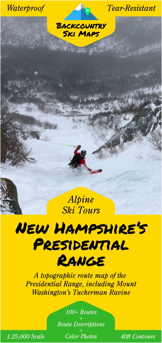
After your beacon, shovel, probe, skis, skins, boots, first aid kit, pants, and Skimo Co headband, a trustworthy map is the most important piece of equipment to bring with you into the backcountry. But don't trust just any map to get you to where you want to ski - if you're headed to the Lake Tahoe area or the snowcapped mountains of New Hampshire, pick up one of the Backcountry Ski Maps that are specially designed to maximize your backcountry touring experience. Each topographic map is drawn to a 1:25,000 scale for plenty of detail and has suggested ascents and descents so you can check off those new objectives as efficiently as possible. Gone are the days of committing the guidebook to memory in the parking lot because on the back of each map is a miniature field guide complete with photos and descriptions of the must-hit routes in the area. Ditch the tiny screen on the GPS you forgot to charge, and the directions drawn on a coffee shop napkin by that dude at the park-and-ride. Instead, pick up your tried and true Backcountry Ski Map and go explore some new terrain.
- Maps are available for the Presidential Range in New Hampshire and various areas around Lake Tahoe.
- Suggested approaches and descents ranked by difficulty are drawn on each map.
- Route descriptions, directions and tips complete with photos are provided on the map for the most notable descents.
- 1:25,000 scale with 40ft contour lines.
- Waterproof and tear-resistant to stand up to abuse in the field.
- 21.25'' by 27'' map folds down to 4.25'' by 9'' to fit in your pack or pocket.
Map areas covered are:
Lake Tahoe - North: Mt. Rose Wilderness and areas around Truckee from Castle Peak down to the northern edge of Squaw Valley. Includes routes on Tamarack Peak, Relay Peak, Donner Peak, Silver Peak and more.
Lake Tahoe - Southwest: Rubicon Peak in the North to Ralston Peak in the South, and from Mt. Price in the East to Flagpole Peak in the West. Includes routes on Mt. Tallac, Jake’s Peak, Pyramid Peak, Dick’s Peak, Echo Peak, Angora Peak, and more.
Lake Tahoe - Carson Pass: Carson Pass area south of Lake Tahoe from Powderhouse Peak to Round Top and Deadwood Peak. Includes lift-accessed backcountry around Kirkwood as well as routes on Waterhouse Peak, Melissa Coray Peak, Fourth of July Peak, Steven’s Peak, and more.
Lake Tahoe - Best of the Rest: Must-ski locales south of Squaw and Alpine Meadows, near Homewood, on the East Shore, in the Jobs-Freel Group, and more. Includes routes on Twin Peaks, Grouse Rock, Trimmer Peak, Freel Peak, Job’s Peak, Ellis Peak, Stanford Rock, and others.
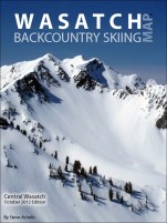
New Hampshire's Presidential Range: The Northern area of the Presidential Range in NH, including routes in Tuckerman Ravine, Huntington Ravine, The Great Gulf, The Gulf of Slides, Jefferson Ravine, Castle Ravine, Oakes Gulf, King Ravine, Burt Ravine, Ammonoosuc Ravine, and more.
Mammoth: A crown Jewel of California, the Mammoth area provides a plethora of ski touring possibilities. Covering the surrounding areas of the Sherwins and Convict Lake Area you will be entertained for a long while trying to tick off all the options. Several classic lines are detailed on the back of the map with greater detail on ascent and descent lines.
Related Products
Questions & Reviews
Comment on this review:
Earn store credit by writing reviews. Learn more.
Overall rating:
Add a photo


